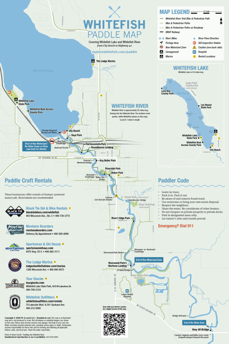
The Whitefish Paddle Map is a project of Safe Trails Whitefish (an initiative of Outdoor Community Partners) and is made possible by the support of Western Montana’s Glacier Country, Whitefish Convention & Visitors Bureau, and Montana Fish, Wildlife & Parks. A special thanks to the City of Whitefish, Whitefish Lake Institute, DREAM Adaptive, and Mike Fitzgerald for their contributions to this map.
About the Project
Through this map, Safe Trails Whitefish sought to create a public information tool for residents and visitors alike, increasing the safety and accessibility around Whitefish Lake and Whitefish River. Much of the navigation of this river to date has been shared through word-of-mouth, independent research, or utilizing online digital apps without all the necessarily data for paddle navigation. With the increase in popularity of the lake and the upper 6 miles of the river, it has become increasingly important to share public information about AIS prevention measures, boating safety, and paddler courtesies.