

Safe Trails Whitefish Initiative
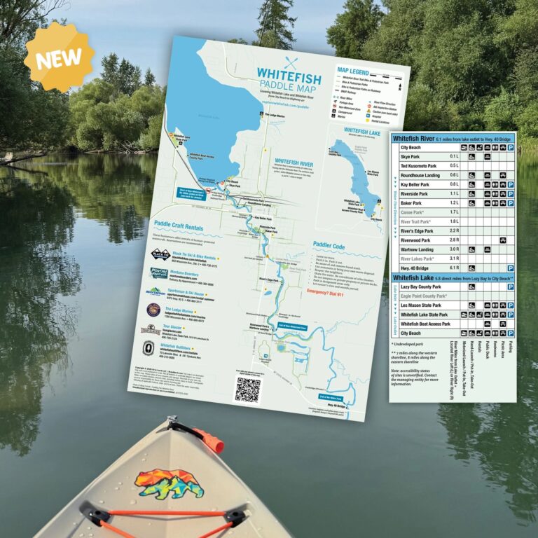
Whitefish Paddle Map
Clear accessible information about river access, safety requirements, AIS compliance, hazards, and responsible use.
The Whitefish River has become an increasingly popular destination for paddleboarding, kayaking, canoeing, and recreational floating. However, many people enter the river without readily available information about where to launch or take out, where to park, how long a trip may take, what hazards they may encounter, or what safety and legal requirements apply.
Questions about river access, travel times, parking, and take-out locations appear frequently on social media, indicating that paddlers are often piecing together information from informal and sometimes unreliable sources. Local first responders have also identified safety concerns.
The Whitefish Fire Department has received calls from people needing assistance who cannot accurately describe where they are on the river. Law-enforcement personnel and community observers have noted alcohol use, the absence of personal flotation devices, and nighttime paddlers traveling without required lights. Many river users are also unaware that aquatic invasive species inspection requirements apply to paddleboards, kayaks, and other watercraft.
These issues are especially concerning because the Whitefish River passes through developed and natural areas where access points, landmarks, emergency response locations, and river conditions are not always obvious to an unfamiliar user. A paddler who does not understand the route or know how to identify their location may have difficulty making safe decisions or communicating effectively with emergency responders.
Safe Trails Whitefish engaged with Fir and Larch Creative to create the Whitefish Paddle Map and close this information gap. The map brings essential route-planning and safety information together in one accessible resource, including put-ins and take-outs, approximate travel times, parking and amenities, known hazards, non-motorized zones, paddler etiquette, personal flotation device and lighting requirements, aquatic invasive species compliance, and recognizable locations that can help paddlers understand and communicate where they are.
The Whitefish Paddle Map is made possible by the support of Western Montana’s Glacier Country, Whitefish Convention & Visitors Bureau, and Montana Fish, Wildlife & Parks. A special thanks to the City of Whitefish, Whitefish Lake Institute, DREAM Adaptive, and Mike Fitzgerald for their contributions to this map.
Safe Trails Whitefish is an initiative of Outdoor Community Partners, a not-for-profit whose focus is building strong communities through lasting work.